
During the summer of 2014 Infrasense, Inc. and Radar Solutions International, Inc. (RSI) teamed up to locate and maps utilities at a Liquid Natural Gas facility in Northeastern Massachusetts. Utility detection was accomplished by using a number of methods; Ground Penetrating Radar (GPR), EM-61 and EM Induction (EMI).
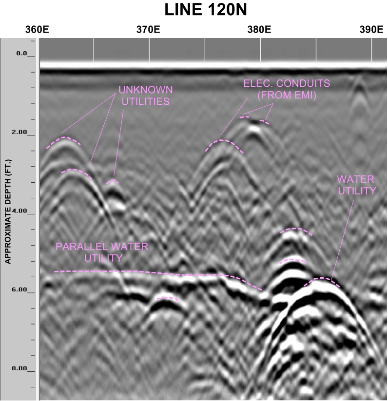
GPR data was collected using GSSI's SIR-3000 and a 400 MHZ antenna that identified a number of features, within the survey area, to a maximum depth of 9 ft. (view animation below). Data was collected in a grid laid out in the survey area with lines spaced at every 2' x 5'. The collected data was then assembled in to a 3D grid using GSSI's Radan 6 for interpretation. The image below shows not only the clarity of the data, but also the many utilities located in the scan area.
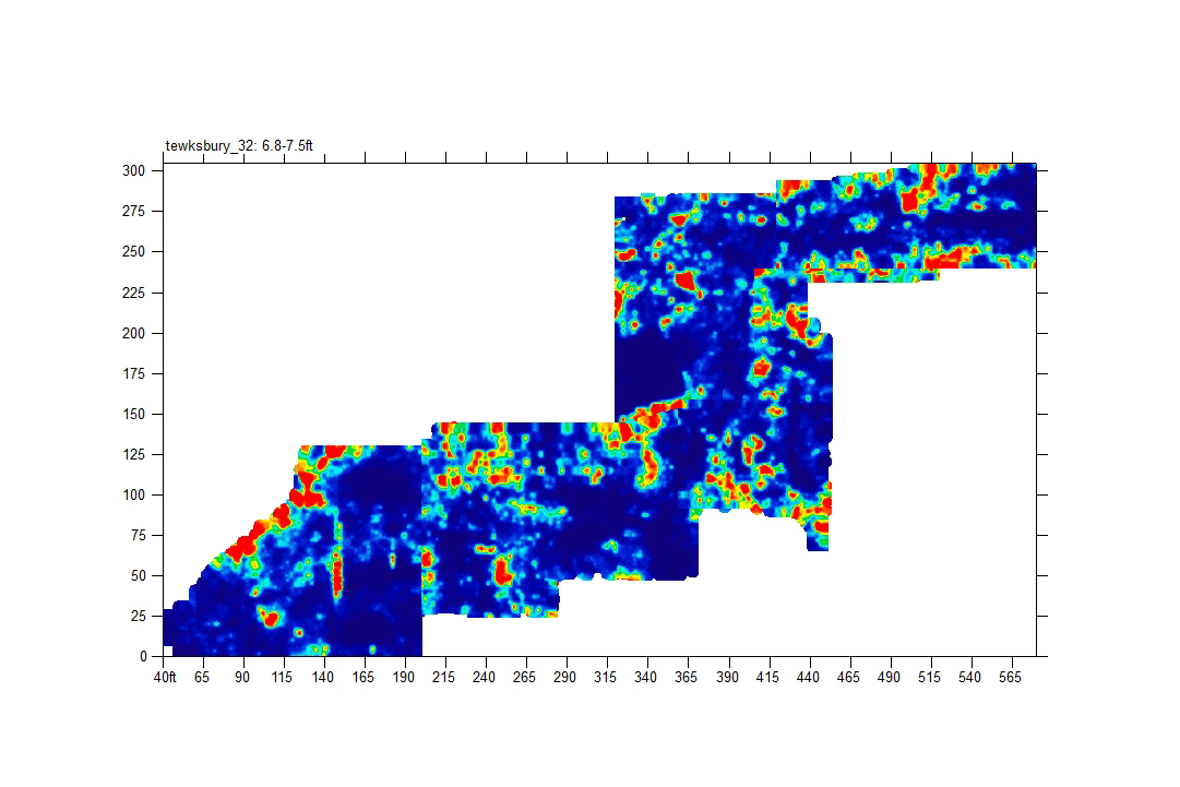
Additionally, some of the features observed from the GPR data correlates with the data collected using Geonic's EM-61. In addition to the GPR data, the EM-61 located a buried re-enforced pad (340E, 180N). The combination of these two methods gave our client complete understanding of subsurface features.
Complementing both the GPR and EM-61 data sets, is the use of our two EM Induction tools; the Radio Detection RD 8000 and the McLaughlin GX. By overlaying our EMI mark outs on top of our GPR and EM-61 results, we were able to classify the different utilities in the sub-surface.
The photo above shows multiple utilities running throughout the survey site.
Acknowledgements: We would like to thank Infrasense, Inc. for their assistance conducting the field work.