
GPR was used at an eastern Massachusetts bridge to help determine the lateral extent of a bridge footing. Data was collected continuously along a 2-foot survey grid using a GSSI SIR System 2 and mono-static 900, 400 and 200 MHz antennas. Common mid-point gather measurements were made using bi-static 400 MHz antennas to determine the interval velocity of the soil. Because of its unexpected shallow depth, the 900 MHz antenna provided the best 2D resolution of the bridge footing's transverse and longitudinal sections. Click on the link below for a more details of this survey.
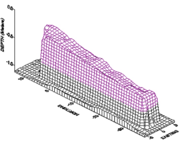
Above: This figure shows the 3D image of the bridge footing, as displayed as depth below ground surface.

Above: Edward Dobson is towing the 400 MHz antenna as he lends a hand with the GPR survey.
Kutrubes, D.L., Maser, K., 1998, Use of GPR in 2D and 3D imaging of bridge footing and scour studies: Symposium for the Applications of Geophysics to Environmental and Engineering Problems (SAGEEP98), March 1998, Chicago, Il., pp. 893-902