Refraction is a geophysical method frequently used for surveying depth to bedrock and investigating groundwater and/or a bedrock water supply queries. Seismic refraction provides density information of subsurface layers.
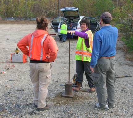
Seismic refraction is based on the principle that the rate at which acoustic energy (i.e. sound waves) travel through the ground, refract along the surface of higher velocity layers, and first arrive at a geophone (i.e. a sensitive device that measures three-component movement of the ground as the acoustic energy moves past it), is proportional to the density of the velocity layers. The more dense a material, the faster the velocity along which acoustic energy travels. Explosives detonated by a licensed blaster or a large weight drop is typically used for the seismic source.
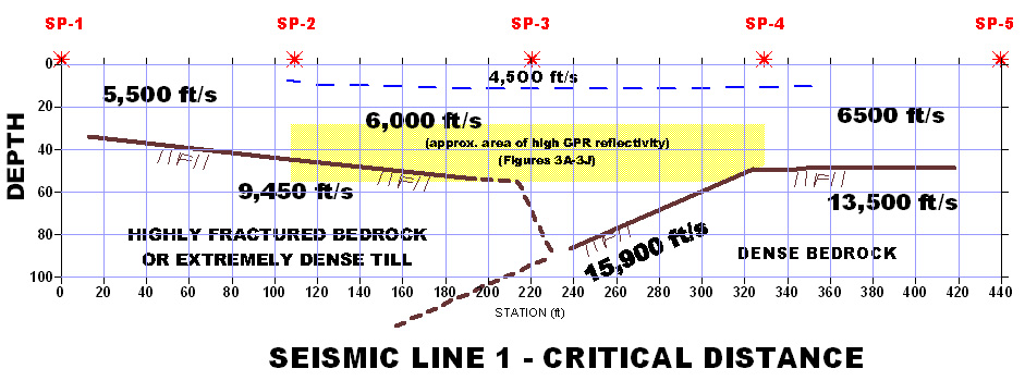
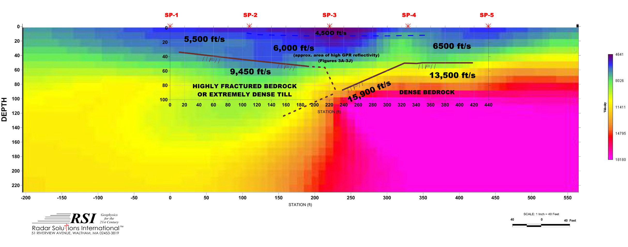
A seismic refraction survey produces data in the form of first arrival times and known distances from wave sources to geophones. RSI uses a 24 channel ABEM Terraloc Mark III seismograph to record geophone first-arrival times. Geophones are usually spaced 10 to 20 feet apart, along lines several hundred feet in length. The data is inverted to obtain depths to refracting body interfaces by the utilization of one or more computational methods. We find it useful to insert a preliminary phase of interpretation that allows us the flexibility to elucidate many of the geological peculiarities that might otherwise lead to interpretational errors. Usually this preliminary interpretation is accomplished by plotting the data on time-distance graphs and fitting velocity curves that honor both known geologic and geophysical constraints and result in a model that is ready for final computation. The figures below show a tomography model as determined using GeoTomo's nonlinear refraction travel time tomography program with seismic refraction critical distance (enlarged above) superimposed. Results are showing a sharp bedrock contact between a low velocity, highly fractured bedrock and a very dense high-velocity bedrock. The low velocity zones observed using both interpretational methods are attributed to fault gouge. The apparent dip of this fault is to the west. Pockets of low velocity bedrock and/or unconsolidated material may be water-bearing.