
Gravity is a methodology used to differentiate between materials of differing densities. In Environmental and Geotechnical projects, gravity can by used to differentiate between bedrock and unconsolidated materials, find caverns, septic tanks, and other voids, as well as delineate landfill from native soil. In Archaeological applications, Gravity can be used to detect small void spaces, such as from tombs. In many instances, the gravity meter may be preferable to and obtain more accurate data than Seismic Refraction, especially in urban environments where noise from vehicular traffic, presence of pavement, and lack of space may be issues. The gravity method is passive, relying on the earth's gravity field as the source, and therefore not limited by propagation problems, as seismic and GPR methods. The Gravity method is also non-invasive, not requiring shot holes or other alternations of the pavement and soil.
The gravity method also does not require long lines and therefore much more flexible than seismic methods. Gravity works well on pavements, even in frost and permafrost conditions, and does not damage structures or cause a disturbance etc. The gravity method is equally effective whether rock is deep or shallow. Appropriately implemented, it can be as accurate or more accurate than seismic work and lends itself well to production of bedrock elevation contour maps. Its main drawbacks are that, for highly accurate work, terrain corrections are necessary where the topography is rugged and geological knowns may be necessary for accurate quantitative interpretation. Therefore, having high-resolution contour maps as well as boring information are desired to increase accuracy.
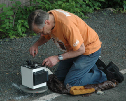
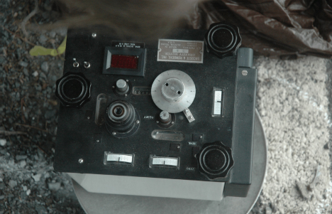
Gravity measuring equipment is very expensive and operator/interpreters must be experienced in the application of geology as well as gravity geophysics. RSI's gravity expert, Dr. John F. Kick, Senior Geophysical Associate with RSI and President of Kick GeoExploration, owns and operates a Lacoste and Romberg Microgravity D-Meter. Below is a photo showing the top of the D-Meter gravimeter as it is positioned on top of a metal plate in the leveled position.
Analysis of the gravity data consists of data reduction and relevant anomaly isolation (often referred to as "regional- residual" separation). Standard Bouguer data reductions are applied to the field measurements with the aid of a computer program. The program makes latitude and elevation corrections, and adjusts base station values to computer generated tidal curves to correct for drift Station latitudes are obtained from GPS or from a USGS topographic map, depending upon the size and anticipated depth of the target and the accuracies desired. Terrain corrections are made on gravity surveys when it is necessary to eliminate the extraneous gravity effects due to the proximity of terrain above and below the elevation of the reading point. On most bedrock gravity surveys, with the exception of those sites with significant topography, terrain corrections are unnecessary or require minimal effort. A Complete Bouguer Gravity Anomaly contour map is produced once results of the above-referenced reductions are completed. The Complete Bouguer Anomaly map is a largely a function of the density contrasts of subsurface masses, including both soil and bedrock. In some types of gravity work the Bouguer map or profiles are the final deliverable, but for quantitative interpretations some further form of anomaly isolation is necessary.
Bouguer gravity anomalies show the effects of structures with varying shapes, sizes, depths and densities. The ability to interpret the data may depend on ones ability to separate relevant data from non relevant data. In the case of bedrock depth surveys this is usually done by the use of gravity values obtained at locations where bedrock depth and the nature of rock and overburden materials is known from borings, seismic results, geologic maps, outcrops etc. These "known values" are often referred to as calibration or ground truth. Gravity modeling programs and regional gravity maps can also help determine regional gravity values over the site. Bedrock depth is determined at each gravity station by calculating the gravity effect of the overburden sediment (soil) mass, and subtracting the regional (rock) value from the observed (Bouguer) values. The accuracy of the bedrock maps can be additionally augmented when bedrock information from the proposed monitoring wells and borings becomes available for calibration.